Information
Map of the areal
GPX 2024 download
On this page you will find maps with parking zones, navigating the the start of the race, and race map.
Parking zone
If you come to the race by car, you can use some of the parking lots.
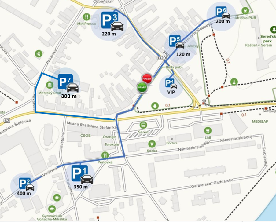
Parking capacity
P1 and P3 over 40 parking places
P5 and P6 10 parking places
P2 and P7 20 parking places
P4 VIP parking zone
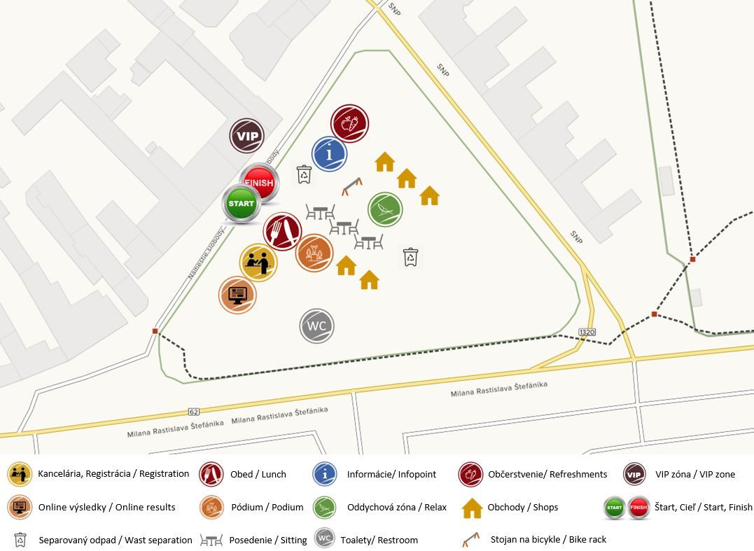
Event map
Map of race background for better orientation.
Route map
The route is still the same with the length 122 km (118 km race) and the superelevation circa 1150 m and consists of plains and hills. The racers ride through 2 regions, 5 districts, 21 communities and 2 cities. On the route there are situated 2 sprint bonuses and 2 mountain bonuses. In the mountain bonus Svrbice is buffet with with water, fruits, gels, energy bars, salt, etc.